
Asterra and National Highways
Award for Digital Innovation
About Category
About This Category
This category is open to any geotechnical company that can show excellence in the way it has used digital technology to improve systems, performance, processes or project delivery within its own business between January 2022 and January 2023. Entries in this category should focus on business-wide innovations and, where applicable, be used on multiple projects. Project-specific innovations should be entered in the Technical Excellence category.
Entries could focus on a particular digital innovation - such as an initiative to improve safety, employment practices, collaboration or delivery - or present how digital innovation is fostered and encouraged across the business and the benefits this is driving.
The innovation could be site or office based, and entrants should present clear evidence of how the innovation has delivered performance, cost, health and safety or reliability improvements for the business and how this benefits both clients and society.
About This Entry
Entry Title
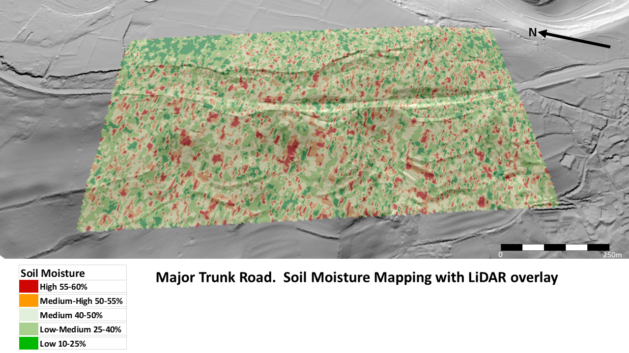
EarthWorks for National Highways
Entry Description
Earth Observation techniques now include ASTERRA’s EarthWorks L-Band PolSAR which enables the user to view concentrations of sub surface soil moisture in areas such as cuttings, embankments and slopes.
This data provides insights into areas of susceptible landslides and poorly performing drainage. EarthWorks soil moisture mapping allowed National Highways to address a selection of problematic sites including existing slope failure surfaces, fault lines and daylighting seepages, by augmenting existing site knowledge with previously unseen/unknown sub surface soil moisture distribution and concentrations.
The ability to view large areas or individual sites without setting foot on the ground reduces the need for site visits, keeping people safe while also reducing the carbon footprint and cost associated with any site works by enabling more efficient and targeted interventions. Spatial coverage can be increased to incorporate above and below infrastructure features within the same image allowing for wide ranging data acquisition and regular monitoring.